Teaching
Teaching Philosophy
My teaching philosophy centers around fostering students' intrinsic motivation to learn. Specifically, I seek to cultivate students' skills and curiosity in GIScience so they can address real-world spatial problems.
Jump to Course Descriptions or Teaching Approaches
Course Descriptions
Geography 365: Cartography and Geospatial Visualization
Taught spring 2026*.
Maps do far more than get us from point A to point B. They help us understand election results, decide whether or not to pack a rain jacket, predict disease outbreaks, and so much more. At their core, maps visualize aspects of the world we could not otherwise see or experience; thereby enabling us to explore and understand geographic phenomena in new ways. Geography 365 (G365) introduces the fundamentals of cartography, defined as the art, science, technologies, and ethics of mapmaking and map use. Mapmaking is the primary emphasis of this course. Accordingly, this course explores evidence-based and time-tested best practices for designing effective maps. These best practices will be introduced in lectures, and the lab component of the course will require you to apply your understanding of lecture material while producing maps. In doing so, you will learn how to design both thematic and reference maps at multiple scales using symbols and visual hierarchies that allow the content of the maps to be effectively communicated. The course will also encourage you to become critical and ethical consumers of maps and geographic data produced by government agencies, industry, and the media. Special attention will be paid to how maps can mislead and distort reality.
*Also taught an equivalent class at Penn State for two semesters
Geography 366: Intermediate Geographic Information Science
Taught fall 2025.
Geographic information science is much more than knowing how to press buttons to use ArcGIS Pro. It is a way of addressing geographic problems by integrating geographic concepts, logical arguments, and workflows. In this course, you will advance your GIS abilities by connecting GIScience concepts to GIS skills and GIS applications. Course meetings will be a mix of lecture and laboratory formats. Lectures will detail key tools and ways of conceptualizing geographic phenomena to address problems. Laboratory exercises highlight the practical uses of QGIS and ArcGIS Pro software to address different types of questions and problems. GEOG 366 prioritizes the use of both QGIS and ArcGIS to ensure that software becomes a crutch in solving spatial problems. Instead, students will be software agnostic and will rely on their GIS skills and knowledge. Students will work with both vector and raster datasets in lab across many domains.
Geography 215: Introduction to Geographic Information Science and Cartography
Taught fall 2025 and spring 2026.
Spatial data are as abundant as they are powerful. Air traffic controllers rely on it to ensure safe aviation. Companies use it to evaluate market potential. Ecologists use it to protect species. The applications of spatial data are endless. However, spatial data must be processed using specific methods and tools in order to become actionable and accessible geographic information. This course offers an introduction to managing, processing, and presenting geographic information. Course material will draw from two sibling disciplines: Geographic Information Science (GIScience) and Cartography. Where GIScience is primarily concerned with the tools and techniques of geographic information systems (GIS), cartography focuses on how to make geographic information presentable by designing effective maps. Course periods will be structured as lectures and labs. Lectures will introduce key concepts including the nature of geographic information, data models, geographic data input, and spatial analysis. Labs will have students apply these concepts using professional GIS software (ArcGIS Pro). This will ensure that students not only understand the underpinning theory and concepts of GIScience and cartography but acquire key technical skills that are highly sought-after by employers. Overall, this course prepares students for advanced study in GIS, remote sensing, cartography, and spatial analysis.
Teaching Approaches
-
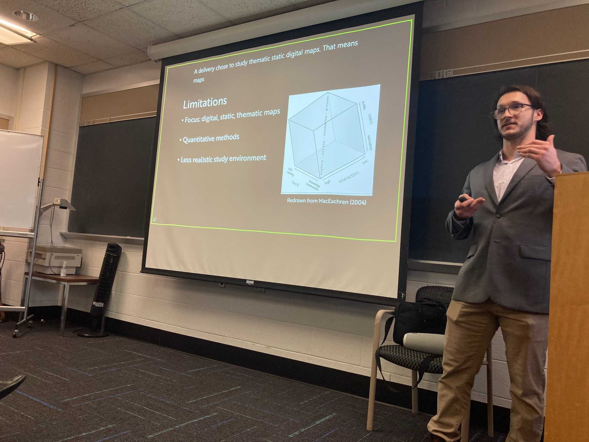
Active Learning: Students learn best when they are actively engaging in the learning process. This is especially the case in cartography and GIS where mastery requires iteration and practice. I embed ample activities including polls, think-pair-share, and jigsaw during class sessions to keep students engaged.
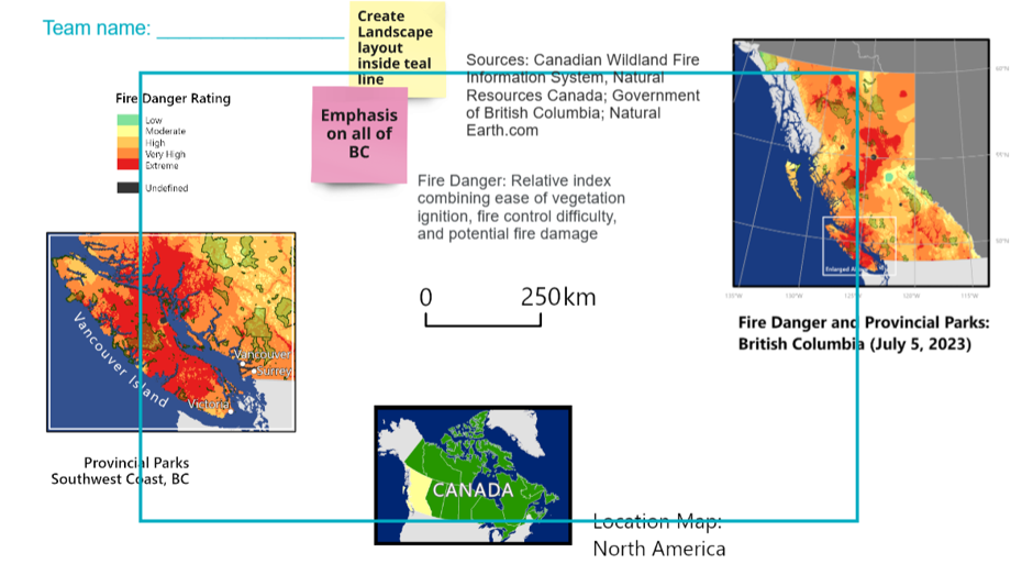
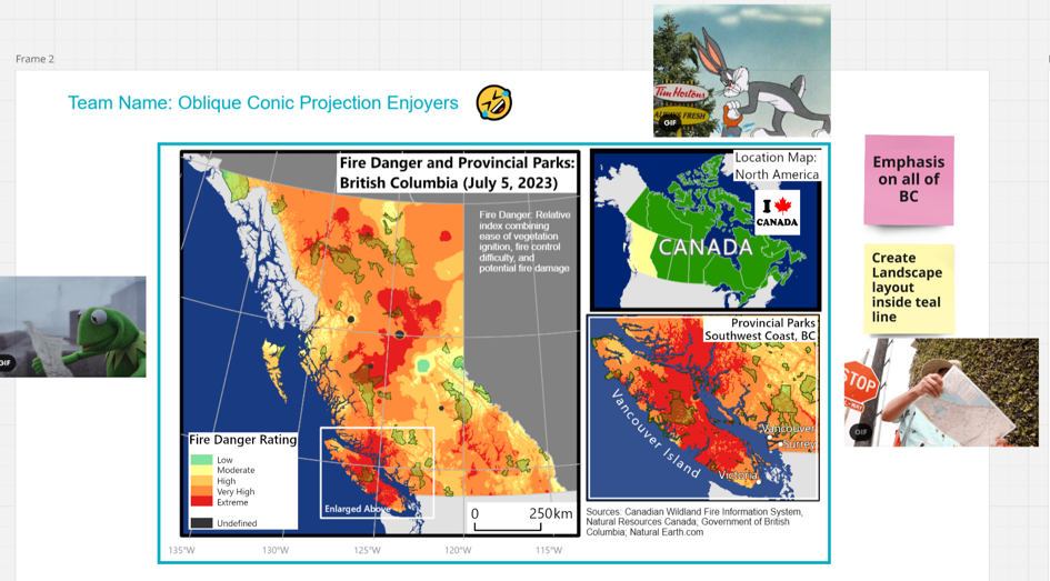
In this example, students were learning about layout and establishing a visual hierarchy on maps. Students were given a set of unorganized map elements and were given design constraints: creating a landscape layout that emphasizes all of British Columbia.
This is what they started with:
This is what they ended up achieving:
-
Relevant Learning: Students perform better and are more likely to retain information when they can see how what they are learning is relevant.
Particularly, students are more invested when they feel a sense of purpose and can connect a class to making a difference in the world.
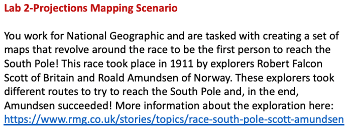
One way I do this is by designing mapping assignments that reflect projects that practicing GIScientists and cartographers would be doing.
Below you can see an overview of a mapping assignment where students take the role of a National Geographic Cartographer.
-
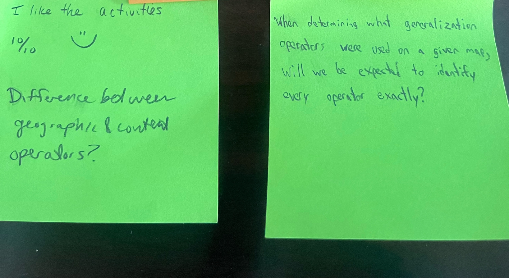
Formative Learning: Students need ample and effective feedback to succeed. Therefore, formative assessment is central to my teaching philosophy.
I use exit slips to identify areas that students need additional help on. On anonymous post-its, students write down a question or two that they have, and I dedicate half of the next class period to answering these questions.
Below you can see some examples of the student exit slips.
- Inclusive Learning: Students have different needs in order to succeed in the classroom. I cultivate an inclusive environment by beginning each course with a collaborative discussion where students and I establish ground rules for respectful participation and create a safe space for learning. I also incorporate diverse perspectives in my course materials by including maps of varying geographic regions, topics, and authors of diverse backgrounds.