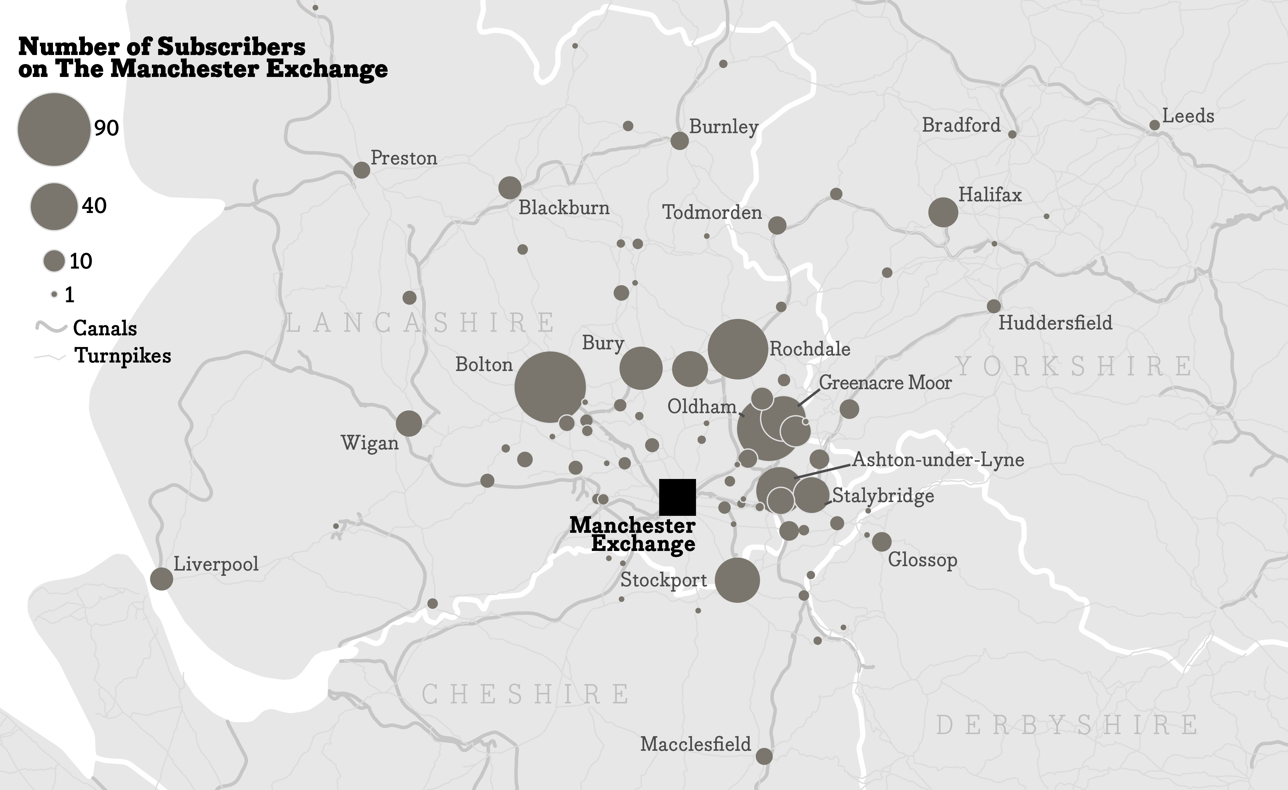
Subscribers to the Manchester Exchange
This map was created for Dr. Deryck Holdsworth, Professor Emeritus of Geography. This map is a product of an iterative dialogue between Deryck and me. Deryck has a wealth of knowledge about cartographic design and even more so about the industrialization of England. I learned so much from him about England and historical geography. The map is an illustrative figure for Holdsworth’s book on the industrialization of England in the 1800s. It shows the number of subscribers to the Manchester Exchange, a hub for cotton and textile trade among other goods. Originally, we were going to highlight the number of subscribers at two different timestamps, but we ended up going with a single year, 1848 as it was more pertinent to the narrative.
Created using Illustrator